做準備
SF72- 三藩市防震準備官方網站。
AlertSF – 這是一個短訊警報系統,在緊急情況發生時,它將通過手機和電郵等向全市所有註冊的居民發出簡短的警告信息。
California Earthquake Authority - CEA 是一個由私人出資公共管理提供民眾災難性保險如:地震保險 的公司,鼓勵加州民眾利用這個保險來降低由地震帶來的損失。
Family Disaster Plan – 由紅十字會指定的計劃工具,可利用它來完成您家庭的防震計劃。
Earthquake Country Alliance - 對地震生存和復原提供的四個步驟。每個步驟都有一組都有在工作處和住家可採取的行動。
Federal Emergency Management Administration – 聯邦緊急事務管理局(FEMA) 為家庭、社區、教師以及防震計劃機構等提供豐富的資源。
Great California Shakeout - Cal OES (州長辦公室緊急應對服務) 有如何安全加固的熱水器鍋爐、如何處理寵物和所需物品列單的印刷版指南。請註冊參與2014年10月16日早上十點十六分的防震演習。
MyHazards – 由Cal OES 提供什麼是有害物質、您所住附近所存在的有害物質和如何減少這些有害物質的網站。
Ready.Gov – FEMA為家庭、商業及兒童學習用提供防災計劃資源。
Small Business Administration – 小型商業局為幫助業者提供在如何保護僱員、減少經濟損失和盡快重新開業等方面的發展計劃。
Earthquake Preparedness Guide for People with Disabilities and Other Access or Functional Needs 為殘障人士提供如何做好地震的準備。
Ready Wrigley - 由 Public Health Preparedness 和 Response at the CDC為兒童提供地震資料。
義工和訓練

Neighborhood Emergency Response Team - NERT 為三藩市地區個人、鄰里團體以及社區各種機構提供的免費訓練課程。
ALERT - The Auxiliary Law Enforcement Response Team (ALERT) 是一個針對在三藩市居住、工作和學習十六歲以上的由義工組成的防災項目。
Disaster Service Workers - 州和市法律要求所有三藩市的政府僱員都被指定為災難服務人員。
Reserve Police Officer Program – 三藩市警察局的預備警察計劃是一項包括有社區成員自願成為預備警察的項目。
San Francisco Medical Reserve Corps – 三藩市的醫療預備軍團 MRC 為志願者提供訓練,為大型的災難發生做好準備。
區域性及全國性
Bay Area Search and Rescue Council - 灣區搜索和救援會有一千多個志願者成員,他們代表了二十多個不同的搜尋和營救機構。
CaliforniaVolunteers – 加州義工是一個州辦公室針對提高加州居民參與義工服務意識的管理項目。
National Medical Reserve Corps –國家醫療預備軍團 (MRC) 是一個全國性義工團體,為增進社區的健康和安全以地方為中心的組織。
教育視聽
California Office of Emergency Services – 學習如為動物做心臟復甦術 CPR 或是在Cal OES’s的YouTube頻道上觀賞。
NERT – 學習如何安全真確使用 煤氣、滅火器和準備應急用品箱。
NERT Training Sessions – 由SFGovTV提供總共五部分的 NERT 訓練視頻,沒部分約三十分鐘。
Stay Safe – SFGovTV的獲獎【確保安全系列】視頻,通過這些簡單步驟學習如何在地震發生前做好準備,以增強您在地震發生時和發生後的安全性。
重建資源

Department of Building Inspection (DBI) Soft Story Program - Part of the City’s Earthquake Safety Implementation Program (ESIP), a thirty-year plan to reduce the impact earthquakes will have on San Francisco.
California Building Code - Title 24 of the California Code of Regulations, known as the California Building Standards Code or just "Title 24," contains the regulations that govern the construction of buildings in California.
San Francisco Building Codes - The San Francisco Public Library's local Building Code page. It contains links to earlier editions of the San Francisco Building Code.
San Francisco Department of Building Inspection - Under the direction and management of the seven-member citizen Building Inspection Commission, to oversee the effective, efficient, fair and safe enforcement of the City and County of San Francisco 's Building, Housing, Plumbing, Electrical, and Mechanical Codes, along with the Disability Access Regulations.
FEMA earthquake publications - For building designers, managers and regulators. Includes records for earthquake publications of interest to seismic design and construction professionals.
Loma Prieta 大地震週年紀念
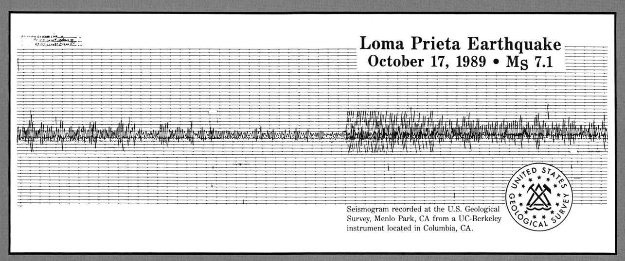
二十五年前的十月十七日下午五點零四分,一個六點九級的地震(通常被稱為Loma Prieta 大地震)震動了整個三藩市灣區。這次地震的死亡人數為四十七人,受傷者超過三千人,且使大約八千人無家可歸。
BART Remembering Loma Prieta - BART presents special coverage looking back at the role BART played as a lifeline, strengthening the system and earthquake tips. Read about memories of employees and riders, see historical photos and watch video stories from some of those who were there.
Loma Prieta Digital Collection - Documents about the Loma Prieta earthquake and more, from the collections of the Government Information Center.
Loma Prieta Earthquake - Anniversary page from the Bay Area Earthquake Alliance.
San Francisco Digital Collections - Images of the 1989 earthquake from SFPL's own Historic Photo Collection.
USGS Loma Prieta - US Geologic Survey historic earthquake page for the 1989 Loma Prieta earthquake.
地震科學

Animations for earthquake terms and concepts - USGS provides animations illustrating 16 different earthquake terms and concepts. A 680 KB zip file of all animations can be downloaded.
California Geological Survey (CGS) - CGS is dedicated to the fulfillment of its mission to provide scientific products and services about the state's geology, seismology and mineral resources that affect the health, safety, and business interests of the people of California.
California Integrated Seismic Network (CISN) - CISN is a partnership among federal, state, and university agencies involved in California earthquake monitoring. The CISN is dedicated to serving the emergency response, engineering, and scientific communities.
Faultline: Seismic science at the Epicenter - Exploratorium online exhibit includes information about the San Francisco earthquakes of 1906 and 1989, plate tectonics and more.
National Institute of Standards and Technology (NIST) - Disaster and failure study from the NIST regarding the 1989 Loma Prieta earthquake.
Shock Waves: One Hundred Years after the 1906 Earthquake This 2006 USGS film (nominated for an Emmy award) shows the century of progress that science and engineering have made since the 1906 San Francisco earthquake. Includes dramatic historical footage, reenactments, colorful animations, and interviews with earthquake experts.
地圖
ABAG Earthquake and Hazards Maps/Info - The Association of Bay Area Governments (ABAG) earthquake mapping project is designed to help residents and local government officials to understand that every region of the Bay Area faces significant earthquake risk from faults far and near and empower them to take actions to reduce their risk.
California Geological Survey (CGS) - Fault maps, historic earthquakes, how the ground is expected to shake, and much more.
California Integrated Seismic Network (CISN) - Maps of recent earthquakes, ShakeMaps for larger earthquakes, email notification, and more.
The California Governor’s Office of Emergency Services (Cal OES) - Geologic and other hazard maps and GIS tools.
California Geological Survey (CGS) - Earthquake Shaking Potential Map of California (Dec. 2008).
Shakeout.org - Historic Bay Area epicenters and faults.
United States Geological Survey, Northern California - Fault and earthquake maps, shaking hazard maps, liquefaction maps, and other information.
灣區市和縣
| Alameda | Contra Costa | Marin | Napa |
| San Francisco | |||
| San Mateo | Santa Clara | Solano | Sonoma |
| Berkeley | Oakland | San Jose | Sunnyvale |
地區性機構:
Bay Area Earthquake Alliance - The Bay Area Earthquake Alliance, which is composed of 182 member groups and organizations, coordinates earthquake awareness and preparedness activities throughout the San Francisco Bay Area. The Alliance is a part of the Earthquake Country Alliance, a statewide alliance linking organizations and individuals that provide earthquake information and services.
Bay Area Rapid Transit (BART) - Earthquake Safety Program for the rapid transit district.
Earthquake and Hazards Program - From the Association of Bay Area Governments (ABAG), covering the nine San Francisco Bay Area counties.

